Jakarta – Indonesia’s air pollution problem is spreading far beyond its biggest cities, with new satellite analysis identifying major nitrogen oxide (NOx) emission hotspots around coal-fired power plants, industrial facilities, mines and rapidly expanding nickel-processing hubs.
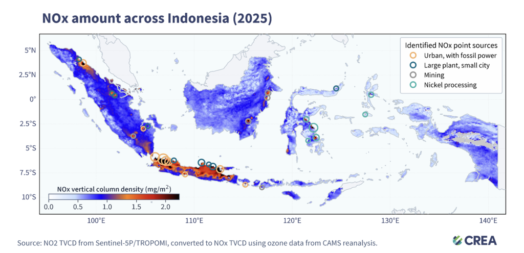
The analysis by the Centre for Research on Energy and Clean Air (CREA), published on Thursday, August 13, identified 29 major NOx point sources across Indonesia. It also points to a broader trend: Indonesia’s NOx emissions have risen sharply over the past decade as transport, power generation and industrial activity have continued to rely heavily on fossil fuels.
The findings offer a different way of looking at Indonesia’s air-quality challenge. Pollution is not simply a problem of Jakarta or other large urban centres. Some of the most significant emission sources are in relatively remote parts of the archipelago, where industrial expansion is creating pollution burdens without comparable public monitoring.
That shift is particularly visible in Indonesia’s nickel-producing regions.
Nickel boom creates a new pollution frontier
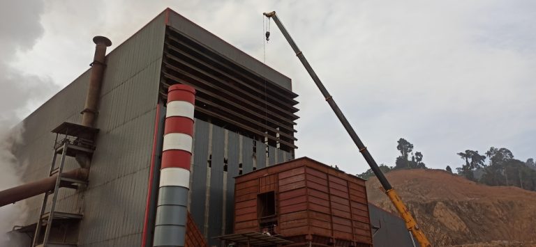
CREA identified six NOx hotspots associated with nickel processing in Sulawesi and North Maluku. The report links their emergence to the rapid expansion of captive coal-fired power plants built to supply energy-intensive smelters and industrial parks.
Captive coal capacity in nickel-producing provinces rose more than six-fold, from about 3 gigawatts in 2019 to 16 GW in 2025, according to the report. The growth accelerated after Indonesia banned exports of raw nickel ore in 2020 and pushed the development of domestic downstream processing.
The result is an unusual pollution geography. The combined NOx emissions from hotspots in Sulawesi and Maluku are estimated at 43.5 kilotonnes, higher than the 37.7 kilotonnes from point sources in Greater Jakarta identified by the study.
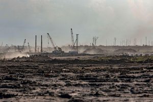
The Indonesia Morowali Industrial Park and other nickel-processing centres in Central and Southeast Sulawesi are among the areas highlighted by the satellite analysis. In North Maluku, the Weda Bay Industrial Park stands out as one of the most rapidly growing NOx hotspots. The facility is powered by a captive coal complex with a capacity of about 4.54 GW, according to the report.
Cities remain major exposure zones
The satellite analysis also confirms that Indonesia’s established urban pollution centres remain significant. Nine of the 29 hotspots are located in or around major metropolitan areas including Jabodetabek, Surabaya and Medan. In these areas, transportation emissions overlap with fossil-fuel power generation and industrial activity, creating shared airsheds that extend beyond administrative boundaries.
North Jakarta and the industrial areas stretching through Bekasi, West Karawang and Cikampek are among the most prominent examples. The report points to gas-fired power stations along the North Jakarta coast and industrial facilities in West Java as major sources contributing to the regional pollution burden.
Banten’s Suralaya complex is another major hotspot. CREA links the area’s pollution to a combination of coal and gas-fired generation and heavy industries including steel, cement and chemicals.
The report cites earlier research estimating that pollution associated with the Suralaya complex exposes millions of people and is linked to 1,063 premature deaths and an estimated USD 1.04 billion in annual economic costs.
A pollution problem that inventories struggle to see
One of the report’s more important findings is methodological as well as environmental. CREA compared satellite observations with global emissions inventories and found that both the Emissions Database for Global Atmospheric Research (EDGAR) and the Community Emissions Data System (CEDS) show a strong increase in Indonesian NOx emissions, although they differ substantially over the scale and sectoral distribution of those emissions.
EDGAR estimates a 46% increase between 2010 and 2022, while CEDS estimates a 59% increase between 2010 and 2023. Both datasets point to transport and power generation as major drivers, but their estimates for the industrial sector differ considerably.
That discrepancy is significant because it points to a basic governance problem: policymakers cannot effectively manage pollution they cannot accurately measure.
Captive coal is the policy blind spot
The satellite findings also expose a tension at the centre of Indonesia’s energy transition. While national decarbonisation policies have focused heavily on the electricity grid, industrial captive power has expanded rapidly. CREA says captive coal capacity serving industrial processing parks increased from 10.4 GW in 2023 to 19.3 GW in 2025, accounting for roughly 80% of new coal additions during that period. The operating, planned, and under-construction captive coal pipeline has reached about 31 GW, according to the report.
Nickel processing is a major driver of this expansion. This creates a policy contradiction, as efforts to reduce pollution and emissions from the public electricity system can be undermined by continued growth in off-grid fossil-fuel capacity serving industrial projects.
CREA argues that existing regulatory exemptions for captive power serving National Strategic Projects have helped create this blind spot. It estimates that excluding captive units from coal retirement targets could result in an additional 27,000 air-pollution-related deaths and USD 20 billion in cumulative economic costs.
From monitoring to enforcement
The report comes as Indonesia strengthens its emissions inventory and air-quality early-warning framework. CREA’s recommendations therefore go beyond calls for better air-quality monitoring.
The organisation is urging the government to enforce stricter ambient air-quality and emission standards, incorporate the health costs of pollution into energy and industrial planning, and combine continuous emissions monitoring, ground-based measurements and satellite data for enforcement.
It also calls for a real-time, publicly accessible emissions dashboard containing stack-monitoring and ambient air-quality data. The organisation also recommends bringing the national ambient air-quality standard closer to health-based benchmarks. CREA notes that Indonesia’s annual NO2 standard remains substantially less stringent than WHO guidelines.
The satellite map ultimately tells a story that conventional air-quality policy risks missing. Indonesia’s pollution is following its economic geography: into industrial estates, mining regions and nickel-processing hubs as well as densely populated cities. (nsh)
Banner photo: North Morowali, Indonesia. 26 Nov 2022. Eklesia_Magelo/shutterstock.com