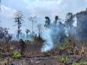
Jakarta — A wildfire that has scorched more than 176 hectares around Mount Bromo in East Java remained under control efforts over the weekend, as Indonesia confronted a growing series of forest and land fires amid an increasingly dry season, Indonesia’s National Disaster Management Agency (BNPB) said on Sunday, August 9.
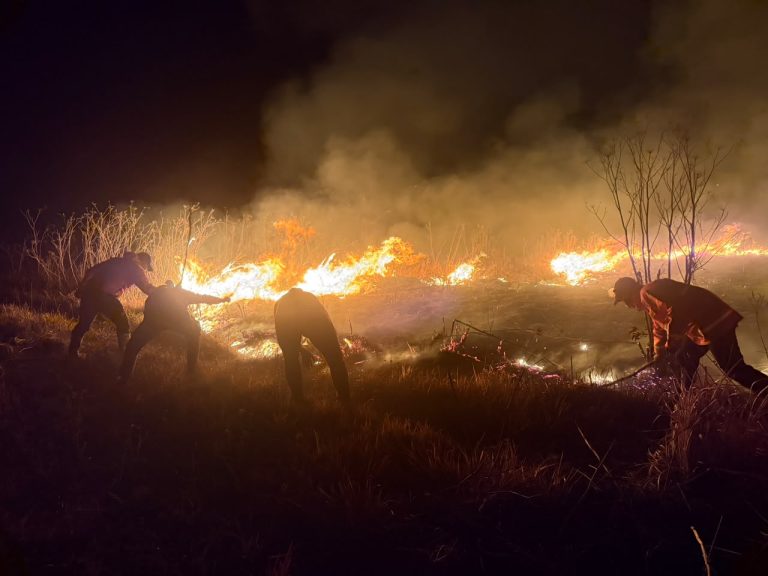
The fire, which began on Monday, August 3, has affected the Gunung Bromo Watu Gede area in Probolinggo and the Jantur area of Bromo Tengger Semeru National Park (TNBTS) in Malang. As of Saturday night, August 8, joint firefighting teams were still battling flames approaching the Tengger Caldera Ring Route (JLKT) road, while hotspots continued to emit smoke in the Pusung Ledok Bedor area.
A separate hotspot that emerged along the Jemplang–Watu Gede route had been brought under control by ground teams, according to Indonesia’s National Disaster Management Agency (BNPB).
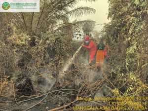
Firefighters have been working both from the ground and the air. Two helicopters, each capable of carrying 1,000 litres of water, have been deployed to reach areas made difficult to access by steep terrain.
The operation has been complicated by the steep slopes of the Bromo caldera, wind conditions and the remote location of some hotspots. Authorities have temporarily closed parts of the Bromo tourist area since August 3, including entrances from Malang and Lumajang.
There have been no reports of deaths from the Bromo fire, while the estimated burned area stood at 176.20 hectares as of the latest BNPB update, with assessment still under way.
Fires spread across other regions
In Ponorogo, East Java, a forest and land fire affected around 10 hectares in Bancangan and Campurejo villages on August 8. The cause was still under investigation, but firefighters had extinguished the blaze by 5 p.m. and continued monitoring the area for possible flare-ups.
In nearby Trenggalek, a fire in a Perhutani forest area in Karangsoko village burned an estimated 1.5 hectares. The cause remained unknown. Teams used manual firefighting and firebreaks to contain the flames, which were extinguished later that afternoon.
Further west in Central Java, a fire in Pekuncen village, Banyumas, burned approximately two hectares after a land-clearing fire spread rapidly into surrounding areas. The blaze was extinguished by August 8, although teams remained on site to prevent renewed fires.
A larger fire also affected the Mount Rinjani National Park area in East Lombok, West Nusa Tenggara. The August 7 fire affected an estimated 30 hectares in the Sembalun area. Twenty-two personnel were deployed, and the fire was brought under control early on August 8, with teams continuing to clear and monitor material that could reignite.
Drought is also affecting communities. In Salatiga, Central Java, declining water supplies have left around 480 people in Kumpulrejo facing water shortages. The local disaster agency has responded by distributing clean water, including 10,000 litres on August 8.
El Niño set to deepen dry-season risks
The fires come as the Meteorology, Climatology and Geophysics Agency (BMKG) warns that Indonesia is facing an unusually dry period, with El Niño expected to persist until at least early 2027.
BMKG said on Thursday, July 30, that El Niño could reach an intensity above the strong category and potentially worsen drought conditions between September and December.
By mid-July, about 54.5% of Indonesia’s land area had entered the dry season. BMKG expects the peak of the 2026 dry season to occur in August across 48.84% of the country’s land area and in September across another 25.41%.
The agency has also recorded prolonged periods without rain, including an 80-day dry spell in Katerban, Purworejo, Central Java. Nearly half of Indonesia’s land area is projected to experience a drier-than-normal dry season, with 437 seasonal climate zones expected to endure longer dry periods.
The heightened dryness is already reflected in fire activity. BMKG had detected 5,019 hotspots by July 29, concentrated mainly in West Kalimantan, South Papua and Riau. The agency warned that the risk of forest and land fires is expected to reach its highest levels during the August–September peak dry season, particularly across vulnerable parts of Sumatra, Kalimantan and South Papua.
BMKG has stepped up weather-modification operations, including cloud seeding, in an effort to generate rainfall before drought and fires intensify. The agency says it has conducted 17 such operations during 2026 to mitigate forest and land fires, covering several provinces including Aceh, Riau, Jambi, South Sumatra and parts of Kalimantan.
But BMKG officials caution that the impact of El Niño on Indonesia is most pronounced when it coincides with the dry season. With the country now approaching the peak of the 2026 dry season, authorities face a potentially difficult period ahead. (nsh)
Banner photo: A joint team continued to work day and night to extinguish the fire on Mount Bromo, East Java, on Saturday, 8 August 2026. Photo source: East Java Provincial Disaster Management Agency (BPBD).